Creating Historic Environment Action Plans
 Historic Environment Action Plans (HEAPs) assesses the significance, condition and forces for change acting upon the historic and archaeological characteristics of a site, place, area, theme or landscape in order to identify actions that will address threats and pursue opportunities.
These assessments should be based on a synthesis of the key historic and archaeological characteristics of the site, place, theme or landscape in question.
Historic Environment Action Plans, therefore, provide a powerful tool for protected landscapes which can help them consider the attributes of the historic environment at a landscape scale, and the way this contributes to the special characteristics of National Parks and Areas of Outstanding Natural Beauty (AONBs). The Historic Environment Action Plan approach provides a mechanism through which a Protected Landscape can systematically and transparently assess the significance, needs and potential of its historic and cultural assets.
You can download a short accessible Overview of Historic Environment Action Plans aimed at protected landscapes.
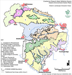
The creation of Historic Character Areas (or Historic Landscape Character Area) provide one method of consolidating historic characterisation data into a more generalised dataset based on geographically specific areas. You can download a methodology for the creation and description of Historic Character Areas
Alternative data on the historic environment of a landscape, site or place can be consolidated into a series of themes. You can download a methodology for the creation and description of Historic Character Themes