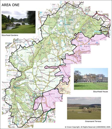
Area 1 Longleat to Penselwood Hills and Kilmington Common
Area 1 is located in the far north-western edge of the Cranborne Chase and West Wiltshire Downs AONB. It comprises the area straddling the Wiltshire and Somerset border and stretches from Longleat in the north to Penselwood in the south.
 Summary Description
- Great swathe of veteran forest which runs from Warminster to just north of the A303 at Penselwood, along the sinuous greensand escarpment.
- Core of the former Medieval forest of Selwood.
- Nationally important historic houses and their associated gardens and parklands.
- Remnants of Medieval deer parks.
- Ancient shire boundary between Wiltshire and Somerset
- Long continuity of land holdings.
- Former common land in vicinity of Kilmington and Horningsham
- Ancient irregular fields in the vicinity of Penselwood.
- Cluster of Medieval motte and bailey castles in the south of the area.
- Ancient quern stone quarries at Pen Pits.
- Dense network of historic routeways.
- Archaeological association of Colt Hoare and Cunnington and the antiquarian book "Ancient Wiltshire".
- Impact of modern tourism in the north of the area with the creation of Centre Parcs and the safari park at Longleat.
The full Historic Landscape Character Area description is available to download from the Historic Environment Action Plan Pages