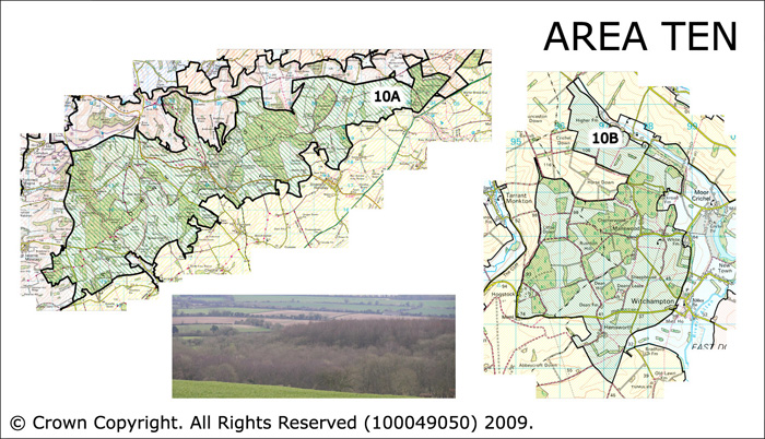
Area 10 Wooded Chalk Downland of the Cranborne Chase and Chetterwood
There are two areas which all form the wooded chalk downland of the Cranborne Chase and Chetterwood Area 10A is centred on Tollard Royal. The Chalk escarpment forms the northern boundary , the Melbury to Blandford Chalk escarpment the western boundary and the Southern Downland Belt the southern boundary. Area 10B Chetterwood is located near to Witchampton to the west of the Allen Valley and bounded by the open southern downland belt to the west and south.
 Summary Description
- The Cranborne Chase wooded chalk downland forms the inner boundary of the Cranborne Chase hunting area, which was divided into a series of walks. Chetterwood is an outlying 'walk'. There is a strong discernable landscape legacy from this history
- Both areas have veteran woodland at their core and are associated with ancient assarts and enclosures.
- Roman roads cross both areas, and there is an ancient network of historic.
- There are remnants of open downland in the north of area 10A.
- The ancient shire boundary (Wiltshire and Dorset) crosses Area 10A
- Area 10A is associated with nationally important designed landscapes.
- The Chase is also firmly associated with the legacy of the archaeologist Pitt Rivers.
- Coherent pattern of ownership through the centuries
- Low density pattern of scattered individual farmsteads and nucleated settlements
- High density of upstanding and known buried archaeological remains including prehistoric sites
The full Historic Landscape Character Area description is available to download from the Historic Environment Action Plan Pages